UK in Maps Get 20% OFF across the Scholastic Shop

- eur prices
-
Save €2.35Offer price: €9.40
- Rewards/RRP: €11.75
Out of stock - due soon
Buy this and your school gets €1.88 to spend on books
This product has not been rated yet.
0 reviews (Add a review)
Delivery information
- FREE ROI postage on orders €40 or over
- €8 postage charge on ROI orders
under €40
Book Club orders
- FREE postage to schools*
- Books will be despatched after the school's order is confirmed
ROI postage within 8 working days
Postage charges and times vary for overseas addresses
Delivery information and refund and returns policy
*Excluding border charge
Product description
The must-have thematic atlas for KS2 and beyond
Bring geography, history and the environment together with this thematic UK atlas suitable for Key Stage 2 and lower Key Stage 3.
Fully up-to-date and endorsed by the Geographical and Historical Associations, it helps children to understand how things came to be, as well as how they might change in years to come.
UK in Maps investigates themes with a focus on environmental issues, energy, transport, farming and tourism and includes reference maps for all the different regions of the UK.
Ideal for classroom use and home learning, it provides opportunities for pupils to conduct their own enquiries and explore maths in context using maps, satellite images, diagrams, charts and photographs.
Also available: World in Maps ISBN 9780008556471
Product Details
Catalogue number
4044 in Schools Catalogue 2025/26
ISBN
9780008556488
Publisher
Date published
March 2nd, 2023
Other details
- 56 pages
Condition
New
Reviews
This product has not been reviewed yet.
Add a review
Customers also bought
-
 World in Maps
SAVE Promo available
- eur prices
- Offer price: €9.40
- Rewards/RRP: €11.75
-
 Alex Neptune, Dragon Thief
-
 Dragon Force: Infinity's Secret
SAVE Promo available
- eur prices
- Offer price: €8.00
- Rewards/RRP: €11.75
-
 Dragon Destiny
SAVE Promo available
- eur prices
- Offer price: €7.00
- Rewards/RRP: €11.75
-

8books
Usborne Beginners History Gold 8 Book SetSAVE Promo available
- eur prices
- Offer price: €30.60
- Rewards/RRP: €68.97
-
 Small in the City
SAVE Promo available
- eur prices
- Offer price: €9.40
- Rewards/RRP: €11.75
-
 The Dictionary Story
SAVE Promo available
- eur prices
- Offer price: €17.60
- Rewards/RRP: €22.04
-

6books
Adventures in STEAM 6 Book SetSAVE Promo available
- eur prices
- Offer price: €52.70
- Rewards/RRP: €79.29
-

7books
Katie's Famous Paintings 7 Book SetSAVE Promo available
- eur prices
- Offer price: €47.70
- Rewards/RRP: €71.93
-
 Be Climate Clever
SAVE Promo available
- eur prices
- Offer price: €8.20
- Rewards/RRP: €10.28
-

4books
All About Religious Celebrations 4 Book SetSAVE Promo available
- eur prices
- Offer price: €29.30
- Rewards/RRP: €44.04
-
 Wishes
SAVE Promo available
- eur prices
- Offer price: €13.00
- Rewards/RRP: €19.10
-

5books
Favourite Scottish Fiction 5 Book SetSAVE Promo available
- eur prices
- Offer price: €38.00
- Rewards/RRP: €57.26
-
 There's No Such Thing as Dragons
SAVE Promo available
- eur prices
- Offer price: €7.00
- Rewards/RRP: €10.28
-
 My Name is a Gift
SAVE Promo available
- eur prices
- Offer price: €9.40
- Rewards/RRP: €11.75
-

6books
Earth's Natural Biomes (6 Book Set)SAVE Promo available
- eur prices
- Offer price: €52.70
- Rewards/RRP: €79.29
-
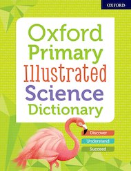
 Oxford Primary Illustrated Science Dictionary
- eur prices
- Offer price: €11.70
- Rewards/RRP: €14.69
-
 Scholastic Classics: Scottish Fairy Tales, Myths and Legends
SAVE Promo available
- eur prices
- Offer price: €6.00
- Rewards/RRP: €11.75
-
 Great Civilisations: Shang Dynasty China
SAVE Promo available
- eur prices
- Offer price: €10.50
- Rewards/RRP: €13.22
-
 Bridges
New
- eur prices
- Offer price: €9.40
- Rewards/RRP: €11.75
-
 Ocean Meets Sky
SAVE Promo available
- eur prices
- Offer price: €11.70
- Rewards/RRP: €13.22
-
 Alive with Poppies
SAVE Promo available
- eur prices
- Offer price: €10.00
- Rewards/RRP: €13.22
-
 Scholastic Classics: Welsh Fairy Tales, Myths and Legends
Award-winning author
- eur prices
- Offer price: €6.00
- Rewards/RRP: €11.75
-
 Climate in Chaos
SAVE Promo available
- eur prices
- Offer price: €9.40
- Rewards/RRP: €11.75
-
 20 Best Assemblies: Festivals
SAVE Promo available
- eur prices
- Offer price: €11.70
- Rewards/RRP: €14.70
-
 Call Me Lion
SAVE Promo available
- eur prices
- Offer price: €9.40
- Rewards/RRP: €11.75
-
 Big Picture: Living Habitats
SAVE Promo available
- eur prices
- Offer price: €10.50
- Rewards/RRP: €13.22
-
 What is AI?
SAVE Promo available
- eur prices
- Offer price: €10.00
- Rewards/RRP: €13.22
-
 Flower Block
New
- eur prices
- Offer price: €9.40
- Rewards/RRP: €11.75
-

5books
Favourite Welsh Fiction 5 Book SetSAVE Promo available
- eur prices
- Offer price: €39.00
- Rewards/RRP: €58.73
Promotions available
Get 20% OFF across the Scholastic Shop
Code: READ20
Get 20% off across the Scholastic Shop. Minimum spend €30. Offer excludes PM, PM Writing, Fast Forward, GCSE 9-1 resources, and Book Fair gift vouchers. Cannot be used in conjunction with any other offers. Can only be used once per customer. Bulk orders of more than 15 book packs or individual titles can only be accepted for delivery to a school setting and not to individual or business addresses. Offer ends at 11.59pm on 28th February 2026.
See all products in this promotion
